
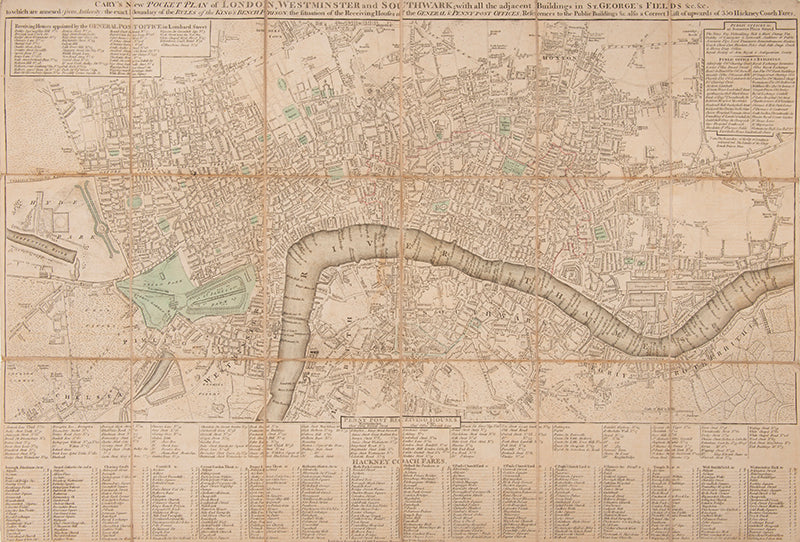
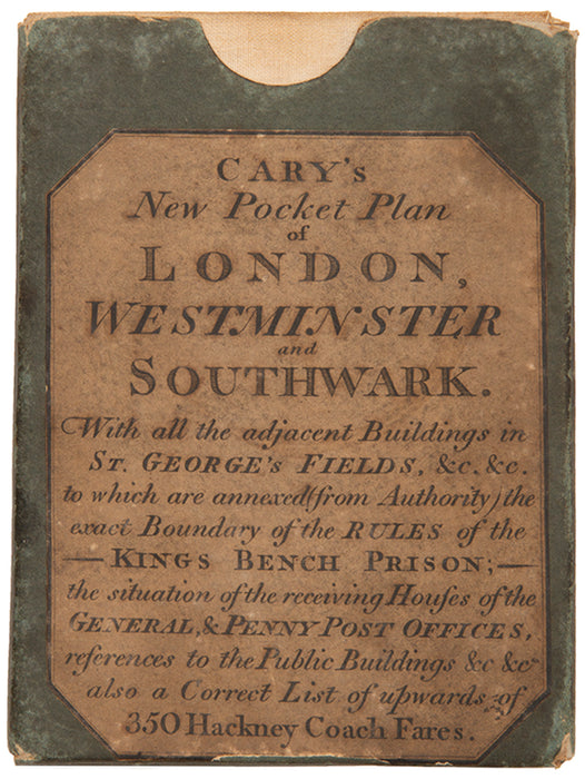
Cary's New Pocket Plan of London, Westminster and Southwark;
with all the adjacent Buildings in St. George's Fields &c. &c. to which are annexed (from Authority) the exact Boundary of the Rules of the King's Bench Prison; the situation of the Receiving Houses of the General & Penny Post Offices; References to the Public Buildings &c. also a Correct List of upwards of 350 Hackney Coach Fares.
Stock Code 108603
London, Printed for J. Cary, 1812
Original price
£750.00
-
Original price
£750.00
Original price
£0.00
£750.00
£750.00
-
£750.00
Current price
£750.00
Cary (1755-1835) was the 'most prominent and successful' cartographer and engraver of the late eighteenth century (Fordham), popularising the pocket plan format that had brought success to the Bowles family in the 1730s.
This edition with imprint dated 1812 is not recorded in Howgego's Printed Maps of London circa 1553-1850 (1978), nor on WorldCat.
Partially coloured folding map, laid on linen as issued; size: 41.5 x 62 cm, 16.25 x 24.25 inches (open); scale: 4 inches : 1 mile; extending from Islington in the North to Newington Butts in the South, and Hyde Park in the West to Stepney Green in the East; with indexes for Hackney Coach Fares, Penny Post Receiving Houses, General Post Office Receiving Houses, and Public Offices & Buildings; green card slipcase with publisher's printed label, a little worn to the edges, map with very minor fraying to extremities, otherwise in very good condition.
Not in Howgego; Worms et al. pp.130-131.
Provenance
Delivery
We offer secure and express delivery on all local and international orders of rare books, maps and prints placed through this website.